Manawatu District (Manawatu District)
Manawatū District is a territorial authority district in the Manawatū-Whanganui local government region in the North Island of New Zealand, administered by Manawatū District Council. It includes most of the area between the Manawatū River in the south and the Rangitīkei River in the north, stretching from slightly south of the settlement of Himatangi in the south, to just south of Mangaweka in the north, and from the Rangitīkei River to the top of the Ruahine Range in the east. It does not include the Foxton area and the mouth of the Manawatū River, or Palmerston North City (which includes Ashhurst). Its main town is Feilding. The district has an area of 2,624 km².
Manawatū is said to have been named by Hau, a great Māori explorer. As he pursued his wife, who had left him for another lover, along the south west coast of the North Island, he came across and named river mouths, including Whanganui, Whangaehu and Rangitīkei according to events that befell him at the time. He then came across the mouth of the large, wide Manawatū River; in awe of the sight and in fear he might not be able to cross it, he said "Ka tū taku manawa" (My heart stands still).
The name Manawatū (often the Manawatu) also refers to the whole area centred on the Manawatū Plains, the floodplain of the Manawatū River, with Palmerston North as its principal city. Like some other areas of New Zealand such as Wairarapa and the King Country, the Manawatū in this sense has never had precisely defined boundaries, its extents determined largely by custom and preference. Always included are Palmerston North and all of today's Manawatū District, and usually included is that part of Horowhenua District lying north of Levin. Parts of Rangitikei and/or Tararua districts might also be included.
Map - Manawatu District (Manawatu District)
Map
Country - New_Zealand
 |
 |
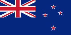
| Flag of New Zealand | |
The islands of New Zealand were the last large habitable land to be settled by humans. Between about 1280 and 1350, Polynesians began to settle in the islands and then developed a distinctive Māori culture. In 1642, the Dutch explorer Abel Tasman became the first European to sight and record New Zealand. In 1840, representatives of the United Kingdom and Māori chiefs signed the Treaty of Waitangi, which in its English version declared British sovereignty over the islands. In 1841, New Zealand became a colony within the British Empire. Subsequently, a series of conflicts between the colonial government and Māori tribes resulted in the alienation and confiscation of large amounts of Māori land. New Zealand became a dominion in 1907; it gained full statutory independence in 1947, retaining the monarch as head of state. Today, the majority of New Zealand's population of 5.1 million is of European descent; the indigenous Māori are the largest minority, followed by Asians and Pacific Islanders. Reflecting this, New Zealand's culture is mainly derived from Māori and early British settlers, with recent broadening of culture arising from increased immigration. The official languages are English, Māori, and New Zealand Sign Language, with the local dialect of English being dominant.
Currency / Language
| ISO | Currency | Symbol | Significant figures |
|---|---|---|---|
| NZD | New Zealand dollar | $ | 2 |
| ISO | Language |
|---|---|
| EN | English language |


